• halaman depan
  • permainan
    petualangan aksi Bisnis simulasi permainan peran Kompetisi olahraga Teka-teki kasual strategi kartu ritme musik Teka-teki kata penembakan penerbangan perkembangan cinta
  • aplikasi
    kantor bisnis Komunikasi dan sosial Gaya hidup dan hiburan belanja online Alat utilitas perjalanan perjalanan manajemen keuangan pembelajaran pendidikan Pembacaan informasi Olahraga dan kesehatan
  • artikel

English 中文(简体) 中文(繁体) 한국어 日本語 Português Español Русский العربية Indonesia Deutsch Français ภาษาไทย
halaman depan aplikasi perjalanan perjalanan German Topo Maps
German Topo Maps
German Topo Mapsunduh
1
2
3
4
5
8

Zombie Gunship Survival

  • Versi 7.7.1
  • kategori perjalanan perjalanan
  • nama paket com.atlogis.germany
  • Perbarui waktu July 14, 2025
  • ukuran 42.09MB
Tentang aplikasi ini

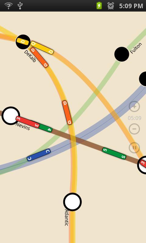
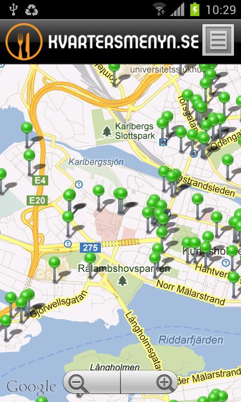
Outdoor GPS Navigation with the best maps and aerial imagery for Germany

+++ NEW ! Harga pengantar! Dapatkan fitur lengkap dengan biaya satu kali kecil. !!! +++

Easy to use Outdoor/Offline GPS navigation app with access to the best topographic maps and satellite images for Norway.

++ For offline use PRO features needed ! ++

Turn your Andoid Phone/Tablet into an outdoor GPS for trips into the backcountry WITHOUT CELL COVERAGE. See your position on different maps, record your track or share your location with others.

Over 50 different map layers for Germany. 10 map layers with worldwide coverage. Plus many overlays like trekking or bicycle routes.

Use official topographical maps to find small pathes, creeks or contour lines.

High resolution aerial imagery, topo maps in up to 1:5.000, digital terrain modells and even cadastre maps for many German states !

OpenStreetMaps with different layouts.

Free map layers for all Germany

• TopPlus: These high resolution maps use best available geodata from German surveying office (BKG)

• WebAtlasDE

• Satellite imagery

• OpenStreetMaps : These crowdsourced maps are a very useful addition to other map layers. Contain many unique features.

• OpenCycleMaps: These maps are ideal to plan bicycle trips (PRO Users only !)

• ESRI Topographic

• ESRI Aerial Images

• ESRI Street Map

• Google Road Map (online access only)

• Google Satellite Images (online access only)

• Google Terrain Map (online access only)

• Bing Road Map (online access only)

• Bing Satellite Images (online access only)

• Earth At Night

• lots of Overlays like hillshading, rivers, lakes, routes, ...

Main features for outdoor-navigation:

• Create and edit Waypoints

• GoTo-Waypoint-Navigation

• Track Recording (with speed, elevation and accuracy profile)

• Tripmaster with fields for odometer, average speed, bearing, elevation, etc.

• GPX/KML/KMZ Export

• Search (placenames, POIs, streets)

• Customizable datafields in Map View and Tripmaster (eg Speed, Distance, Compass, ...)

• Share Waypoints, Tracks or Routes (via eMail, Whatsapp, Dropbox, Facebook, ..)

• Display coordinates in Lat/Lon, UTM or MGRS/USNG (Military Grid/ US National Grid)

• Record & share tracks with statistics & elevation profile

• Rotate map (Track Up & North Up)

• Get Elevation and Distance by long click on map

• Track Replay

• Add custom map tile servers

• and many more ...

Available Pro features: (Pro features available via In App Purchase)

• Offline Use - no cell coverage needed. No Roaming fees !

• Easy+Fast Bulk-download of map tiles for OFFLINE USAGE (not for Google and Bing maps)

• Create and edit Routes

• Route-Navigation (Point-to-Point Navigation)

• GPX/KML/KMZ Import/Export

• unlimited Waypoints & Tracks

• Add other Map Tile-Server

• No Ads

Offline Use:

All viewed map tiles are kept in cache. To cache large areas you need to purchase Pro features.

Gunakan aplikasi navigasi ini untuk kegiatan di luar ruangan seperti hiking, bersepeda, berkemah, memanjat, berkendara, bermain ski, kano, berburu, tur 4WD offroad atau pencarian & penyelamatan (SAR).

Add custom waypoints in longitude/latitude, UTM or MGRS/USNG format with WGS84 datum.

Import/Export/Share GPS-Waypoints/Tracks/Routes in GPX or Google Earth KML/KMZ format.

Preload FREE map data for areas without cell service (Pro feature !).

Comments and feature requests to [email protected]

Have a look at our other outdoor navigation apps: https://play.google.com/store/search?q=atlogis

+++ We DO NOT track any user activities or collect any user data ! +++
What's New in the Latest Version 7.7.1

Last updated on Mar 9, 2025 ・Unterstützung für Android 15
・Cache Maps bezogene Fehlerbehebungen
・Neuer ALKIS Layer für Niedersachsen
・Verbesserungen & Korrekturen
tangkapan layar
German Topo Maps
German Topo Maps
German Topo Maps
Pengguna juga melihat
  • AMTRAN-Altoona Bus

    AMTRAN-Altoona Busr

    1.0 September 1, 2025
    8.5
    1
    2
    3
    4
    5
  • Aplicativo Vai Vem

    Aplicativo Vai Vemr

    18.18 September 1, 2025
    7.6
    1
    2
    3
    4
    5
  • Mi Taxista

    Mi Taxistar

    1.3 August 31, 2025
    8.5
    1
    2
    3
    4
    5
  • Haunted Alton

    Haunted Altonr

    1.06 August 31, 2025
    7.7
    1
    2
    3
    4
    5
  • Gebrauchtwagen Deutschland

    Gebrauchtwagen Deutschlandr

    4.0 August 30, 2025
    8.7
    1
    2
    3
    4
    5
  • Travelzone - Tiket Online

    Travelzone - Tiket Onliner

    6 August 30, 2025
    7.3
    1
    2
    3
    4
    5
  • Go Drivo

    Go Drivor

    2.4 August 29, 2025
    8.4
    1
    2
    3
    4
    5
  • School Bus Tracking System

    School Bus Tracking Systemr

    1.18 August 29, 2025
    8.8
    1
    2
    3
    4
    5
  • TOYOTA E-CATALOG

    TOYOTA E-CATALOGr

    2.1 August 28, 2025
    7
    1
    2
    3
    4
    5
  • Modifikasi Mobil Terbaru

    Modifikasi Mobil Terbarur

    1.2 August 28, 2025
    8.8
    1
    2
    3
    4
    5
Anda mungkin juga tertarik
  • Castle Building Construction Games

    Castle Building Construction Gamesr

    1.0 September 2, 2025
    7.5
    1
    2
    3
    4
    5
  • SuperHeroes Jump

    SuperHeroes Jumpr

    1.3.0 September 2, 2025
    8.5
    1
    2
    3
    4
    5
  • Movies Crossword

    Movies Crosswordr

    1.1.7 September 2, 2025
    9.3
    1
    2
    3
    4
    5
  • Hip Hop Street Dance Battle -

    Hip Hop Street Dance Battle -r

    1.1 September 2, 2025
    7.3
    1
    2
    3
    4
    5
  • Cubedise

    Cubediser

    1.09 September 2, 2025
    7.8
    1
    2
    3
    4
    5
  • Mini Free Games

    Mini Free Gamesr

    1.0 September 2, 2025
    8.9
    1
    2
    3
    4
    5
  • Police Simulator Job Cop Game

    Police Simulator Job Cop Gamer

    1.7 September 2, 2025
    8.8
    1
    2
    3
    4
    5
  • Sizzling Hot Slot

    Sizzling Hot Slotr

    1.0 September 2, 2025
    7.4
    1
    2
    3
    4
    5
  • Infinite Dungeons

    Infinite Dungeonsr

    0.3.6b September 2, 2025
    9
    1
    2
    3
    4
    5
  • Danh Bai Doi Thuong 2016

    Danh Bai Doi Thuong 2016r

    2.0.02 September 2, 2025
    7.2
    1
    2
    3
    4
    5
Kategori Permainan
  • petualangan aksipetualangan aksi
  • Bisnis simulasiBisnis simulasi
  • permainan peranpermainan peran
  • Kompetisi olahragaKompetisi olahraga
  • Teka-teki kasualTeka-teki kasual
  • strategi kartustrategi kartu
  • ritme musikritme musik
  • Teka-teki kataTeka-teki kata
  • penembakan penerbanganpenembakan penerbangan
  • perkembangan cintaperkembangan cinta
Klasifikasi Aplikasi
  • kantor bisniskantor bisnis
  • Komunikasi dan sosialKomunikasi dan sosial
  • Gaya hidup dan hiburanGaya hidup dan hiburan
  • belanja onlinebelanja online
  • Alat utilitasAlat utilitas
  • perjalanan perjalananperjalanan perjalanan
  • manajemen keuanganmanajemen keuangan
  • pembelajaran pendidikanpembelajaran pendidikan
  • Pembacaan informasiPembacaan informasi
  • Olahraga dan kesehatanOlahraga dan kesehatan
About Privacy Policy Terms of Service Cooking Policy

© Copyright 2017-2025 downtj.com